Paulinskill Valley Rail Trail
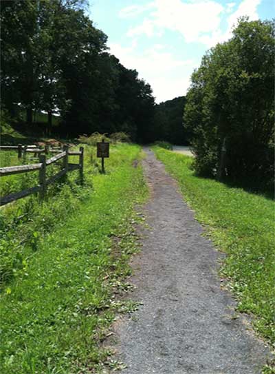 A multipurpose trail for walking, horseback riding, biking and cross country skiing.
The trail runs along the Paulins Kill river and is the sixth longest trail in the state at 27 miles.
Trail Points (Sussex County): Sunset Inn Road, Sparta Junction to Cedar Ridge Road, Stillwater Township.
Trail Length (Sussex County): Approximately 27 miles.
Facilities: Multiple parking areas along trail. Restrooms located at various trail heads. Portions of trail are wheelchair accessible.
Main Parking Area is at Warbasse Junction. Please see the Sussex Skylands Trail Map for other parking areas along the trail.
How to get to WARBASSE JUNCTION via ROUTES 206 AND 94:
GPS Coordinates: 41.085293, -74.699741
Routes 206 and 94 North through Newton and continue north for 2½ miles. At the light near the Mercedes dealership, turn right to follow Route 94 North. Continue two miles to Warbasse Junction Road (Route 663). Turn right and go one half mile to a parking lot on the right which is diagonally across from the house at 280 Warbasse Junction Road, Lafayette Township, NJ 07848.
WARBASSE JUNCTION via ROUTE 15
GPS Coordinates: 41.085293, -74.699741
Route 15 into Lafayette Township, NJ. Turn onto Route 94 South. Stay on Route 94 South approximately 1 mile. Turn left onto Warbasse Junction Road (Route 663). Continue one half mile south to parking lot on the right which is diagonally across from the house at 280 Warbasse Junction Road, Lafayette Township, NJ 07848.

